|
Trails
Union PeakDirections: take Deer Valley Road to 16th Street in North Phoenix. Head South for two city blocks until street dead ends at the base of the hill.
Parking: Dirt lot
Facilities: None
Length: 1/4 mile
Description: the trail is an old mining road for the Union mine. You will see a mining shaft and old equipment. It is kind of dumpy. The trail goes to the east side of the mountain, however, it does not reach the summit.
Jurisdiction: BLM
Difficulty: 3/10 steep, rocky
Review: 6/10 nice view of Paradise and Deer Valleys but lots of junk though. Reach 11 Park
211:
210:
Papago Park
Get aerial photos and maps of Phoenix Mountain Prserves
Phoenix Mountain Preserve Trails
Trail 100:
Directions: The Trail begins at Mountain View Park at 7th Ave and Mountain View and it ends 1/4 mile South of Tatum and Doubletree Ranch Road.
Parking: Tatum and Doubletree, 40th and Shea, Dreamy Draw Park, 7th St and Thunderbird, Central and Thunderbird, 7th Ave and Cheryl Drive
Facilities: Water at Mtn View Park,7th Street, Dreamy Draw. Bathrooms at Mtn View and Dreamy Draw.
Length: 7 miles
Description: The trail is for hikers, bikers, and horses. It connects Shaw Butte, North Mtn, Stoney Mtn, Dreamy Draw and Squaw Peak. It is really long but fairly easy. It goes underneath 7th Street, Cave Creek Road, and SR51 in drainage tunnels.
Difficulty: 4/10 steep at Stoney Mountain, rocky at Dreamy Draw and its length.
Review: 10/10 It is my favorite trail because it is the most interesting. It takes you through most of the mtns.
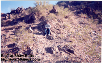
Go to http://www.bigtnews.50megs.com/images/trail100_map.jpg to see a map of the trailShaw Butte Trail
306:
North Mountain Trails:
40:
60:Directions: Start at Mtn View Park
Parking: Paved
Facilities: Water, Restroom
Length: 1.5 miles
Description: A loop trail that is an old mining road, you'll see mining ruins and a cave. You'll see Central Ave and Central Business district
Difficulty: 3/10 rocky, steep at begining
Review: 7/10 pretty neat, the cave and the Central Ave Tunnel
404:
44:
Squaw Peak Trails
300:
302:
200:
304:
8:
1A
202:
Lookout Mountain:
150:
308:
Stoney Mountain North:
25:
Camelback Mtn
Cholla Trail
Picture of Lookout Mountain
|
|


